A17 Tunnel Doelzschen Pesterwitz.jpg
From Underfoot

Size of this preview: 800 × 600 pixels. Other resolutions: 320 × 240 pixels | 640 × 480 pixels | 1,024 × 768 pixels | 1,280 × 960 pixels | 2,272 × 1,704 pixels.
Original file (2,272 × 1,704 pixels, file size: 1.17 MB, MIME type: image/jpeg)
Summary
| Description |
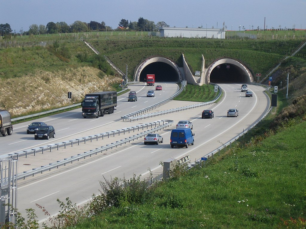
Deutsch: Dölzschener Tunnel der Bundesautobahn 17, Einfahrt Roßthal/Pesterwitz
English: Dölzschen Tunnel of the german Autobahn 17, entrance Roßthal/Pesterwitz |
| Date | |
| Source | Own work |
| Author | burts |
| Object location | | View this and other nearby images on: OpenStreetMap |
|---|
| Camera location | | View this and other nearby images on: OpenStreetMap |
|---|
Licensing
I, the copyright holder of this work, hereby publish it under the following licences:

|
Permission is granted to copy, distribute and/or modify this document under the terms of the GNU Free Documentation Licence, Version 1.2 or any later version published by the Free Software Foundation; with no Invariant Sections, no Front-Cover Texts, and no Back-Cover Texts. A copy of the licence is included in the section entitled GNU Free Documentation Licence. |
| This file is licensed under the Creative Commons Attribution-Share Alike 3.0 Unported licence. | ||
| ||
| This licensing tag was added to this file as part of the GFDL licensing update. |
This file is licensed under the Creative Commons Attribution-Share Alike 2.5 Generic, 2.0 Generic and 1.0 Generic licence.
- You are free:
- to share – to copy, distribute and transmit the work
- to remix – to adapt the work
- Under the following conditions:
- attribution – You must give appropriate credit, provide a link to the licence, and indicate if changes were made. You may do so in any reasonable manner, but not in any way that suggests the licensor endorses you or your use.
- share alike – If you remix, transform, or build upon the material, you must distribute your contributions under the same or compatible licence as the original.
You may select the licence of your choice.
File history
Click on a date/time to view the file as it appeared at that time.
| Date/Time | Thumbnail | Dimensions | User | Comment | |
|---|---|---|---|---|---|
| current | 17:16, 29 September 2006 | | 2,272 × 1,704 (1.17 MB) | wikimediacommons>Burts |
File usage
The following 43 pages use this file:
- Kiessee Leuben
- VEB Steinkohlenwerk Freital
- Gießmannscher Tunnel
- Ehemaliger Ratssteinbruch Dölzschen
- Motorway tunnel Dresden-Coschütz
- Cottaer Tunnel
- Steinbruch Zschauitz
- Tongrube Kmehlen
- Marienschacht
- tunnel Wiener Platz
- Fußgängertunnel Neustädter Markt
- Vehmhöhle
- Drei-Brüder-Schacht
- Kiesgrube Sporbitz
- Kiesgrube Zschieren-Süd
- Kiesgrube Zschieren-Nord
- Tunnel Dölzschen
- Dark appareille
- Hocksteinhöhle
- Besucherbergwerk „Marie Louise Stolln"
- Porphyrbruch Dobritz
- Tiefer Elbstolln
- Himmelfahrt Mine
- Segen-Gottes-Schacht
- Tagesstrecke Unteres Revier
- Tiefer Weißeritzstolln
- Königin-Carola-Schacht
- Oppelschacht
- Germany road tunnel
- royal coal mine Zauckerode
- Meiselschacht
- Diebskeller
- Alte Mordgrube
- Tunnel Edle Krone
- Nadelöhr
- Tunnel Weesenstein
- Friedrich August Erbstolln mine
- Moritzschacht
- Zivilschutzbunker Hans-Dankner-Straße, Dresden
- Zivilschutzbunker Liliengasse, Dresden
- Zivilschutzbunker Seidnitzer Straße, Dresden
- Grenzschacht
- Bramschtunnel