Clayton Tunnel, West Sussex, England - May 2012.jpg
From Underfoot
Size of this preview: 476 × 599 pixels. Other resolutions: 191 × 240 pixels | 381 × 480 pixels | 610 × 768 pixels | 814 × 1,024 pixels | 1,628 × 2,048 pixels | 3,796 × 4,776 pixels.
Original file (3,796 × 4,776 pixels, file size: 5.82 MB, MIME type: image/jpeg)
Summary
| Description |
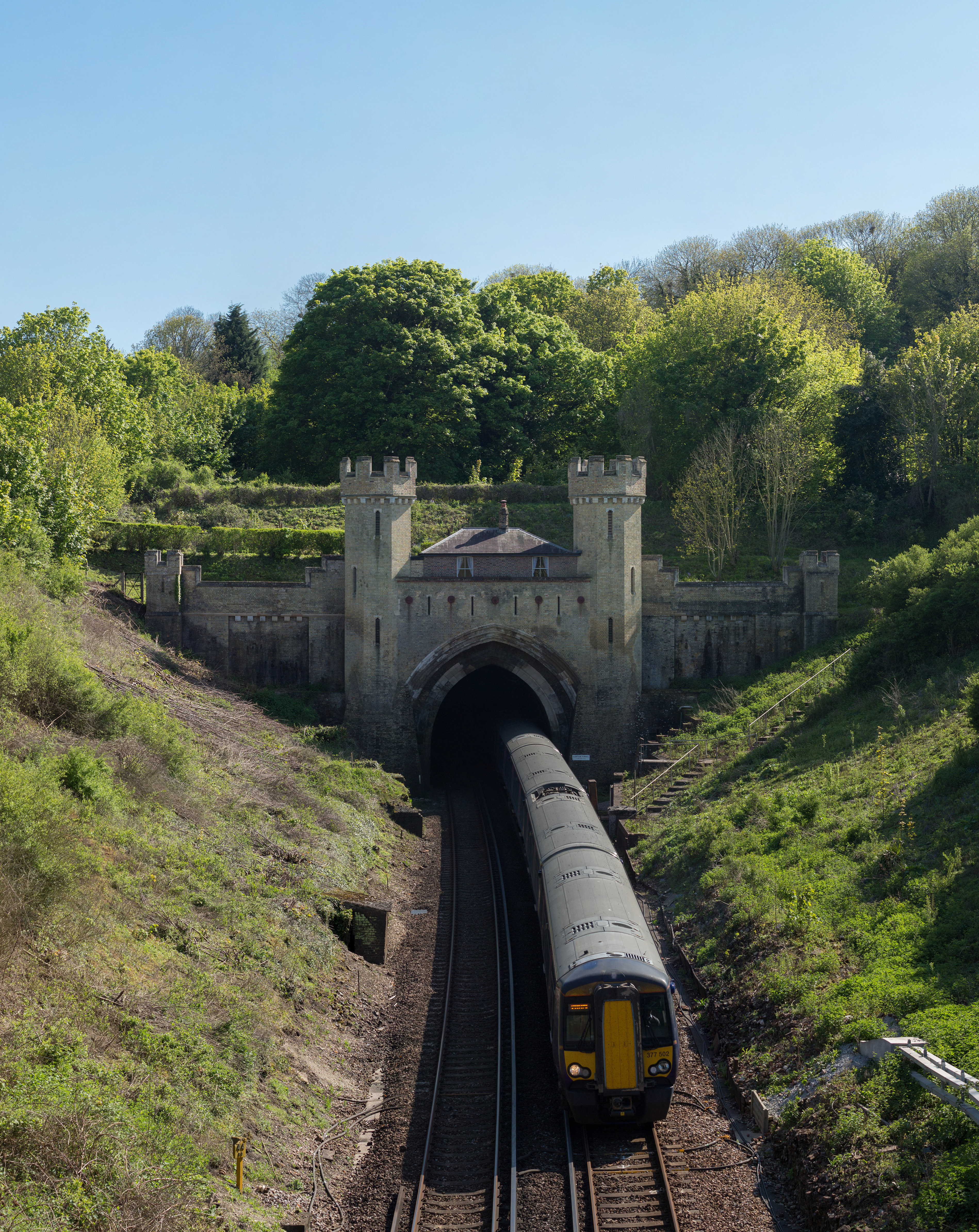
English: Clayton Tunnel as viewed from the north in West Sussex, England. |
| Date | |
| Source | Own work |
| Author | Diliff |
| Permission (Reusing this file) |
Summary:In using this image or any subsequent derivatives of it, you are required to release the image under the same license. As such, any reproduction of this image, in any medium, must appear with a copy of, or full URL of the license.Attribution of this image to the author (DAVID ILIFF) is also required, preferably in a prominent location near the image.No other conditions may be added to, or removed from this license without the permission of the author and copyright holder.Suggested attribution: "Photo by DAVID ILIFF. License: https://creativecommons.org/licenses/by-sa/3.0/"Please review the full license requirements carefully before using this image. If you would like to clarify the terms of the license or negotiate less restrictive commercial licensing outside of the bounds of GFDL/CC-BY-SA, please contact me by email, or if you don't have a Wikipedia account you can either leave a message on my talk page with your contact details and your request, or you can contact me on Facebook. Please also send a 'friend request' to ensure that I am aware of your message. |
| Camera location | | View this and other nearby images on: OpenStreetMap |
|---|
Licensing
I, the copyright holder of this work, hereby publish it under the following licences:
This file is licensed under the Creative Commons Attribution-Share Alike 3.0 Unported licence.
- You are free:
- to share – to copy, distribute and transmit the work
- to remix – to adapt the work
- Under the following conditions:
- attribution – You must give appropriate credit, provide a link to the licence, and indicate if changes were made. You may do so in any reasonable manner, but not in any way that suggests the licensor endorses you or your use.
- share alike – If you remix, transform, or build upon the material, you must distribute your contributions under the same or compatible licence as the original.

|
Permission is granted to copy, distribute and/or modify this document under the terms of the GNU Free Documentation Licence, Version 1.2 or any later version published by the Free Software Foundation; with no Invariant Sections, no Front-Cover Texts, and no Back-Cover Texts. A copy of the licence is included in the section entitled GNU Free Documentation Licence. |
You may select the licence of your choice.
File history
Click on a date/time to view the file as it appeared at that time.
| Date/Time | Thumbnail | Dimensions | User | Comment | |
|---|---|---|---|---|---|
| current | 21:05, 14 May 2012 | | 3,796 × 4,776 (5.82 MB) | wikimediacommons>Diliff | {{Information |Description ={{en|1=Clayton Tunnel as viewed from the north in West Sussex, England.}} |Source ={{own}} |Author =Diliff |Date =2012-05-13 |Permission ={{Diliff/Licensing}} |other_versions ... |
File usage
The following 23 pages use this file:
- Unknown
- Heathfield Tunnel
- Lewes Tunnel
- Baynards Tunnel
- Sharpthorne Tunnel
- Horsham Royal Observer Corps Group Headquarters
- Crawley Borough Emergency Centre
- Horsham District Council Emergency Centre
- United Kingdom railway tunnel
- Clayton Tunnel
- Flint mines on Windover Hill, 140m WSW of The Long Man
- Prehistoric flint mine and part of a round barrow cemetery at Blackpatch, 400m north east of Myrtle Grove Farm
- Asham Quarry
- Balcombe Tunnel
- Cissbury
- Haywards Heath Tunnel
- Marehill Quarry
- Slinfold Stream and Quarry
- Cuilfail Tunnel
- Patcham Tunnel
- Southerham Grey Pit
- Southwick Hill Tunnel
- Hardham Canal Tunnel