Dannemora mining area.jpg
From Underfoot

Size of this preview: 800 × 600 pixels. Other resolutions: 320 × 240 pixels | 640 × 480 pixels | 1,024 × 768 pixels | 1,280 × 960 pixels | 2,560 × 1,920 pixels | 3,648 × 2,736 pixels.
Original file (3,648 × 2,736 pixels, file size: 4.11 MB, MIME type: image/jpeg)
Summary
| Description |
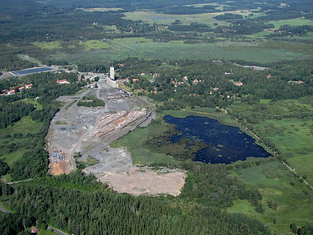
English: The Dannemora mining area, viewed in NW direction. The historic part is to the right of the modern concrete plant with its high tower. The old wooden bell-tower is seen on the green grass, and the light grey strip behind it is the opencast "Storrymningen". At the far right, there is an old red elevator tower among the trees. |
| Date | |
| Source | Own work |
| Author | Rolf Broberg |
| Object location | | View this and other nearby images on: OpenStreetMap |
|---|
Licensing
I, the copyright holder of this work, hereby publish it under the following licences:

|
Permission is granted to copy, distribute and/or modify this document under the terms of the GNU Free Documentation Licence, Version 1.2 or any later version published by the Free Software Foundation; with no Invariant Sections, no Front-Cover Texts, and no Back-Cover Texts. A copy of the licence is included in the section entitled GNU Free Documentation Licence. |
This file is licensed under the Creative Commons Attribution-Share Alike 3.0 Unported, 2.5 Generic, 2.0 Generic and 1.0 Generic licence.
- You are free:
- to share – to copy, distribute and transmit the work
- to remix – to adapt the work
- Under the following conditions:
- attribution – You must give appropriate credit, provide a link to the licence, and indicate if changes were made. You may do so in any reasonable manner, but not in any way that suggests the licensor endorses you or your use.
- share alike – If you remix, transform, or build upon the material, you must distribute your contributions under the same or compatible licence as the original.
You may select the licence of your choice.
File history
Click on a date/time to view the file as it appeared at that time.
| Date/Time | Thumbnail | Dimensions | User | Comment | |
|---|---|---|---|---|---|
| current | 16:48, 9 August 2009 | | 3,648 × 2,736 (4.11 MB) | wikimediacommons>Rolf B | {{Information |Description={{en|1=The Dannemora mining area, viewed in NW direction. The historic part is to the right of the modern concrete plant with its high tower. The old wooden bell-tower is seen on the green grass, and the light grey strip behind |
File usage
The following 2 pages use this file: