Dzerzhinsky District, Kaluga Oblast, Russia - panoramio (133).jpg
From Underfoot

Size of this preview: 800 × 450 pixels. Other resolutions: 320 × 180 pixels | 640 × 360 pixels | 1,024 × 576 pixels | 1,280 × 720 pixels | 2,560 × 1,440 pixels | 4,608 × 2,592 pixels.
Original file (4,608 × 2,592 pixels, file size: 2.57 MB, MIME type: image/jpeg)
.jpg)
Summary
| Description |
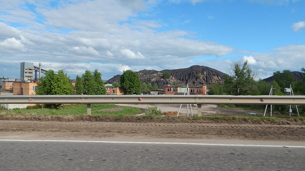
Русский: Терриконы Куровской шахты[1]. Посёлок Куровской до 2012 года находился в составе Дзержинского района Калужской области. Ныне входит в состав Ленинского округа города Калуги. Шахта была открыта в 1958 году, добывали на ней бурый уголь. Закрыта в начале 90-х, шахту затопили, входы засыпали. Сейчас заброшена. Посёлок Куровской интересен тем, что летом 2008 года злоумышленники за одну ночь разобрали 720 погонных метров рельсов подъездного пути к шахте. |
||
| Date | Taken on 20 May 2016 | ||
| Source | https://web.archive.org/web/20161103124446/http://www.panoramio.com/photo/130525939 | ||
| Author | Анатолий Таранцов | ||
| Permission (Reusing this file) |
This file is licensed under the Creative Commons Attribution 3.0 Unported licence. Attribution: Анатолий Таранцов
|
||
| Panoramio Tags | Dzerzhinsky District |
| Camera location | | View this and other nearby images on: OpenStreetMap |
|---|
.jpg¶ms=054.532471_N_0035.993281_E_globe:Earth_type:camera_source:Panoramio_&language=en-gb)
File history
Click on a date/time to view the file as it appeared at that time.
| Date/Time | Thumbnail | Dimensions | User | Comment | |
|---|---|---|---|---|---|
| current | 14:10, 7 July 2017 | | 4,608 × 2,592 (2.57 MB) | wikimediacommons>Panoramio upload bot | == {{int:filedesc}} == {{Information |description=Dzerzhinsky District, Kaluga Oblast, Russia |date={{Taken on|2016-05-20}} |source=http://www.panoramio.com/photo/130525939 |author=[http://www.panoramio.com/user/8541991?with_photo_id=130525939 Анат... |
File usage
There are no pages that use this file.
.jpg)