Fairy Cave Quarry and cave entrance (geograph 5027685).jpg
From Underfoot

Size of this preview: 800 × 600 pixels. Other resolutions: 320 × 240 pixels | 640 × 480 pixels | 1,024 × 768 pixels | 1,280 × 960 pixels | 1,920 × 1,440 pixels.
Original file (1,920 × 1,440 pixels, file size: 989 KB, MIME type: image/jpeg)
.jpg)
Summary
| Description |
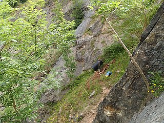
English: Fairy Cave Quarry and cave entrance |
| Date | |
| Source | From geograph.org.uk |
| Author | Nick Chipchase |
| Permission (Reusing this file) |
Creative Commons Attribution Share-alike license 2.0 |
| Attribution (required by the licence) | Nick Chipchase / Fairy Cave Quarry and cave entrance / |
| Camera location | | View this and other nearby images on: OpenStreetMap |
|---|
.jpg¶ms=051.226562_N_-002.490290_E_globe:Earth_type:camera_source:geograph-osgb36(ST65864760)_heading:67.00&language=en-gb)
| Object location | | View this and other nearby images on: OpenStreetMap |
|---|
.jpg¶ms=051.226650_N_-002.490000_E_globe:Earth_class:object_type:object_source:geograph-osgb36(ST65884761)_heading:67.00&language=en-gb)
Licensing

|
This image was taken from the Geograph GB & Eire project collection. See this photograph's page on the Geograph website for the photographer's contact details. The copyright on this image is owned by Nick Chipchase, and is licensed for reuse under the Creative Commons Attribution Share-Alike 2.0 license.
|
This file is licensed under the Creative Commons Attribution-Share Alike 2.0 Generic licence.
Attribution:
Nick Chipchase
- You are free:
- to share – to copy, distribute and transmit the work
- to remix – to adapt the work
- Under the following conditions:
- attribution – You must give appropriate credit, provide a link to the licence, and indicate if changes were made. You may do so in any reasonable manner, but not in any way that suggests the licensor endorses you or your use.
- share alike – If you remix, transform, or build upon the material, you must distribute your contributions under the same or compatible licence as the original.
File history
Click on a date/time to view the file as it appeared at that time.
| Date/Time | Thumbnail | Dimensions | User | Comment | |
|---|---|---|---|---|---|
| current | 20:54, 6 April 2019 | | 1,920 × 1,440 (989 KB) | wikimediacommons>Belbury | Transferred from geograph.co.uk using [https://tools.wmflabs.org/geograph2commons/ geograph2commons] |
File usage
More than 100 pages use this file. The following list shows the first 100 pages that use this file only. A full list is available.
.jpg)
- Underwood Quarry
- Whatley quarry, Somerset
- Cheddar Caves And Gorge - Museum of Prehistory
- Museum of Bath Stone
- Buckhorn Weston Tunnel
- Chilcompton Tunnel
- Saltford Tunnel
- Twerton Tunnel
- Twerton Wood Tunnel
- Shute Shelve Tunnel
- Combe Hay Tunnel
- Flax Bourton Tunnel
- Redcliffe Tunnel
- Staple Hill Tunnel
- Middlehill Tunnel
- St Anne's Tunnel
- Fox's Wood Tunnel
- Bradford Tunnel
- Lansdown Anti-Aircraft Operations Room
- Bristol Royal Observer Corps Group Headquarters
- Bedminster Sub Control
- Holwell Quarries
- Hunter's Hole
- Northern Stormwater Interceptor, Bristol
- Reservoir Hole
- Devonshire Tunnel
- Goldney Hall Grotto
- Kennet and Avon Canal Tunnel (under Beckford Road)
- Kennet and Avon Canal Tunnel (under Cleveland House and Sydney Road)
- Grottoes, 350 Metres South West Of Rear Of The Chantry
- Elms Colliery
- Outlook Cave
- Picken's Hole
- Bracelet Cave
- Gough's Old Cave
- Vobster Breach colliery, 890m ENE of Tweed Farm
- Brandy Bottom Colliery
- Rowberrow Cavern, Mendip Forest
- Velvet Bottom
- Warrens Hill
- Grotto And Bridge Adjacent To East Of No 71 (The Tower House)
- Grotto And Screen Wall, About 100 Metres To The South West Of Farleigh Castle
- Grotto In Grounds Of Copper Beeches (No 82 Victoria Road)
- Grotto And Entrances Flanking And Below Road About 50 Metres North East Of Brockley Hall
- Grotto To Rear Of Westcombe Stables
- Grottos To West Of Warmley House
- Grotto And Garden Wall Approximately 20 Metres South Of Frontage Of Holdenhurst
- Grotto Underpass
- Grotto, 150 Yards To South Of Claverton Manor
- Bathwick Covered Way (MLN1/106 24 & 106 29)
- Grotto Approx 30M N Of Lower Lodge To Prior Park
- Grotto In Grounds Of The Bath Spa Hotel Approx. 40M To The West
- Grotto Below South Terrace At Crowe Hall
- Grotto And Tunnel In The Gardens At Chilton Priory
- Redcliffe Caves
- United Kingdom cave
- Gripwood Quarry
- Gough's Cave
- Wookey Hole Caves
- Attborough Swallet
- Balch Cave
- Banwell Caves
- Banwell Ochre Caves
- Batts Combe Quarry
- Box Mine
- Callow Rock quarry
- Central Government War Headquarters
- Charnage Down Chalk Pit
- Charterhouse Cave
- Cloud Quarry
- Colemans Quarry
- Combe Down Tunnel
- Compton Martin Ochre Mine
- Cox's Cave
- Dead Maid Quarry
- Doulting Stone Quarry
- Dulcote Quarry
- Eastwater Cavern
- Fairy Cave Quarry
- Frogden Quarry
- GB Cave
- Goatchurch Cavern
- Gurney Slade quarry
- Hadspen Quarry
- Hillier's Cave
- Lamb Leer
- St Cuthbert's and Chewton lead mines and Fair Lady Well
- Longwood Swallet
- Manor Farm Swallet
- Pierre's Pot
- Quarry Steps, Durdham Down
- RAF Rudloe Manor
- Radstock Museum
- Read's Cavern
- Rhino Rift
- Rod's Pot
- Shatter Cave
- Shute Shelve Cavern
- Sidcot Swallet
- Siston Hill Colliery
View more links to this file.
.jpg)