Penberthy Mine - geograph.org.uk - 20333.jpg
From Underfoot
No higher resolution available.
Penberthy_Mine_-_geograph.org.uk_-_20333.jpg (640 × 480 pixels, file size: 156 KB, MIME type: image/jpeg)
Summary
| Description |
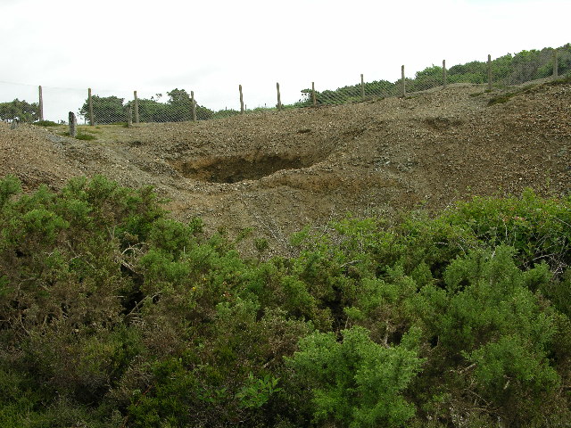
English: Penberthy Mine. This is one of several disused mineshafts in the area. A bit of research turned up the fact that this was a copper mine originally, later mined for tin also. Closed around 1840. |
| Date | |
| Source | From geograph.org.uk |
| Author | Stuart and Fiona Jackson |
| Attribution (required by the licence) | Stuart and Fiona Jackson / Penberthy Mine / |
| Object location | | View this and other nearby images on: OpenStreetMap |
|---|
_&language=en-gb)
Licensing

|
This image was taken from the Geograph GB & Eire project collection. See this photograph's page on the Geograph website for the photographer's contact details. The copyright on this image is owned by Stuart and Fiona Jackson, and is licensed for reuse under the Creative Commons Attribution Share-Alike 2.0 license.
|
This file is licensed under the Creative Commons Attribution-Share Alike 2.0 Generic licence.
Attribution:
Stuart and Fiona Jackson
- You are free:
- to share – to copy, distribute and transmit the work
- to remix – to adapt the work
- Under the following conditions:
- attribution – You must give appropriate credit, provide a link to the licence, and indicate if changes were made. You may do so in any reasonable manner, but not in any way that suggests the licensor endorses you or your use.
- share alike – If you remix, transform, or build upon the material, you must distribute your contributions under the same or compatible licence as the original.
File history
Click on a date/time to view the file as it appeared at that time.
| Date/Time | Thumbnail | Dimensions | User | Comment | |
|---|---|---|---|---|---|
| current | 04:26, 30 January 2010 | | 640 × 480 (156 KB) | wikimediacommons>GeographBot | == {{int:filedesc}} == {{Information |description={{en|1=Penberthy Mine. This is one of several disused mineshafts in the area. A bit of research turned up the fact that this was a copper mine originally, later mined for tin also. Closed around 1840. }} | |
File usage
The following 40 pages use this file:
- United Kingdom copper mine
- Camborne School Of Mines Geological Museum And Art Gallery
- Poldark Mine & Open Air Museum
- Redruth Tunnel
- Sparnick Tunnel
- Perran Tunnel
- Funnel Hole
- Wheal Coates
- Truro Royal Observer Corps Group Headquarters
- Truro Cornwall County Emergency Centre
- Wheal Prosper Mine
- Great Condurrow Mine
- King Edward Mine
- United Kingdom lead mine
- Tin mine calciner at Botallack Mine
- Tregurtha Downs mine complex
- Wheal Trewavas
- Mortar outcrop at Trenear, 9m north east of Poldark Mine entrance
- Levant Mine and Beam Engine
- South Wheal Frances Mine
- Wheal Owles
- South Crofty
- Geevor Tin Mine
- Cape Cornwall Mine
- Consolidated Mines
- Cornish Mines and Engines
- Dolcoath mine
- East Pool mine
- Great Work Mine
- Higher Levant Mine
- Mount Wellington Tin Mine
- Penberthy Croft Mine
- Poldark Mine
- Poldice Mine
- Rosemanowes Quarry
- Wheal Alfred
- Wheal Busy
- Wheal Jane
- Wheal Vor
- Carn Galver Mine