Rim Rock Drive west lower tunnel.JPG
From Underfoot

Size of this preview: 388 × 600 pixels. Other resolutions: 155 × 240 pixels | 310 × 480 pixels | 497 × 768 pixels | 662 × 1,024 pixels | 1,325 × 2,048 pixels | 3,604 × 5,570 pixels.
Original file (3,604 × 5,570 pixels, file size: 13.95 MB, MIME type: image/jpeg)
|
This is an image of a place or building that is listed on the National Register of Historic Places in the United States of America. Its reference number is 94000310 (Wikidata). |
Summary
| Description | |
| Date | |
| Source | Own work |
| Author | Jeffrey Beall |
| Camera location | | View this and other nearby images on: OpenStreetMap |
|---|
Licensing
I, the copyright holder of this work, hereby publish it under the following licence:
This file is licensed under the Creative Commons Attribution 4.0 International licence.
- You are free:
- to share – to copy, distribute and transmit the work
- to remix – to adapt the work
- Under the following conditions:
- attribution – You must give appropriate credit, provide a link to the licence, and indicate if changes were made. You may do so in any reasonable manner, but not in any way that suggests the licensor endorses you or your use.
File history
Click on a date/time to view the file as it appeared at that time.
| Date/Time | Thumbnail | Dimensions | User | Comment | |
|---|---|---|---|---|---|
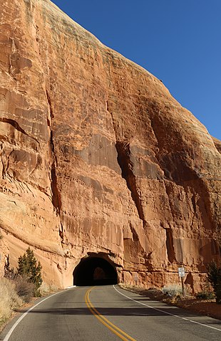
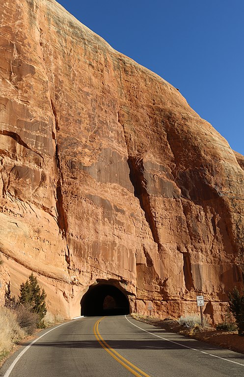
| current | 13:50, 29 February 2020 | | 3,604 × 5,570 (13.95 MB) | wikimediacommons>Jeffrey Beall | {{Information |description ={{en|1=The west lower tunnel on {{W|Rim Rock Drive}} in {{W|Colorado National Monument}}.}} |date =2020-02-27 |source ={{own}} |author =User:Jeffrey Beall }} {{Location|39|6|45.59|N|108|44|9.17|W}} Category:Rim Rock Drive Category:Road tunnels in Colorado Category:February 2020 in Colorado |
File usage
The following 54 pages use this file:
- United States road tunnel
- Abbot Pit
- Allen Pit
- Amax Uranium Mine
- Anchor Mine
- Black Diamond Mine
- Boyer Mine
- Boyer Peacock Mine
- Burk Pit
- C-G-26 Mine
- Campbell Number Two Mine
- Coal Gulch Coal Mine
- Cole Pit
- Colorado Copper Properties Mine
- Corcoran Mine
- Egger Pit 501
- Farmer Coal Mine
- Farmers Number Two Mine
- Fruita Mine
- Fruita Number Two Mine
- Fruita Ready Mix Pit
- Garvey Mine
- Gearhart Mine
- George Cocharan Mine
- Golden Pit
- Grassie and Cozzette Mine
- Grasso Mine
- Herron and Strong Pit
- Hi-Grade Mine
- Hicks Mine
- Hidden Treasure Mine
- Himes Drilling Mine
- Holland Mine
- Huffer Pit
- Hunter Mine
- Hy Grade Mine
- Jarvis Coal Mine
- Kelehen Mine
- Lane Mine
- Book Cliff mines
- McGinley Mine
- Midway Farmer Number Three Mine
- Monarch Mine
- Nearing Mine
- Old Black Diamond Mine
- Peacock Mine
- Riverside Sand and Gravel Pit
- Smith Aggregate Pit
- Stove Canyon Mine
- Thomas Mine
- United Sand and Gravel Pit
- William Mine
- East Tunnel
- West Lower Tunnel