Schweizersbild Ausgrabungen.jpg
From Underfoot
Size of this preview: 800 × 573 pixels. Other resolutions: 320 × 229 pixels | 640 × 458 pixels | 1,024 × 733 pixels | 1,280 × 917 pixels | 2,560 × 1,833 pixels | 3,181 × 2,278 pixels.
Original file (3,181 × 2,278 pixels, file size: 5.59 MB, MIME type: image/jpeg)
Summary
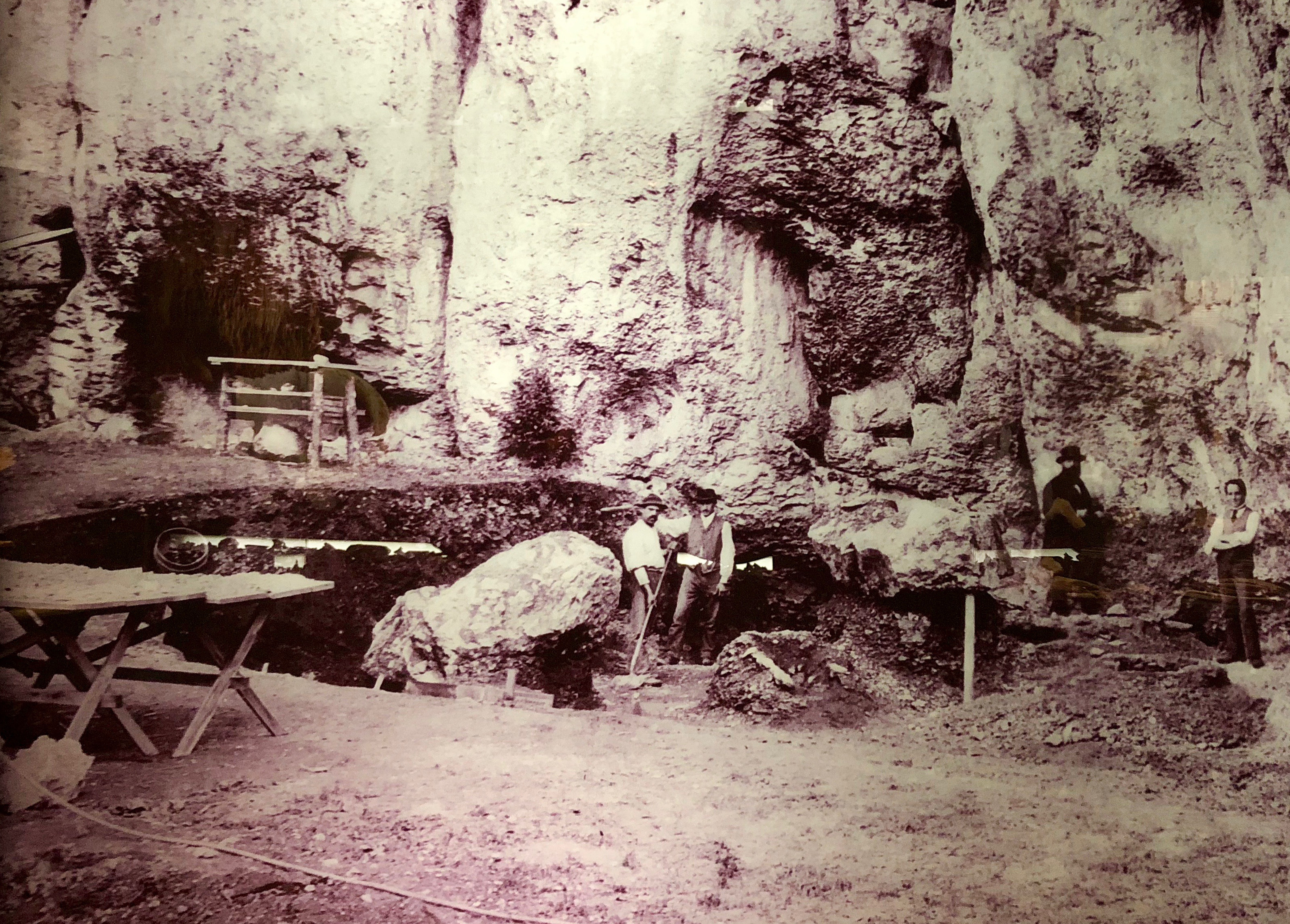
| Description | Modell eines prähistorischen Lagers in Schweizersbild. |
| Date | |
| Source | Own work |
| Author | Unknown author |
| Camera location | | View this and other nearby images on: OpenStreetMap |
|---|
Licensing
I, the copyright holder of this work, hereby publish it under the following licences:

|
Permission is granted to copy, distribute and/or modify this document under the terms of the GNU Free Documentation Licence, Version 1.2 or any later version published by the Free Software Foundation; with no Invariant Sections, no Front-Cover Texts, and no Back-Cover Texts. A copy of the licence is included in the section entitled GNU Free Documentation Licence. |
This file is licensed under the Creative Commons Attribution 3.0 Unported licence.
- You are free:
- to share – to copy, distribute and transmit the work
- to remix – to adapt the work
- Under the following conditions:
- attribution – You must give appropriate credit, provide a link to the licence, and indicate if changes were made. You may do so in any reasonable manner, but not in any way that suggests the licensor endorses you or your use.
You may select the licence of your choice.
Licensing
|
This work is in the public domain in its country of origin and other countries and areas where the copyright term is the author's life plus 70 years or fewer. | |
| This file has been identified as being free of known restrictions under copyright law, including all related and neighbouring rights. | |
File history
Click on a date/time to view the file as it appeared at that time.
| Date/Time | Thumbnail | Dimensions | User | Comment | |
|---|---|---|---|---|---|
| current | 18:07, 10 November 2018 | | 3,181 × 2,278 (5.59 MB) | wikimediacommons>Parpan05 | == {{int:filedesc}} == {{Information |Description= Modell eines prähistorischen Lagers in de:Schweizersbild |Source={{own}} |Date={{1893}} |Author={{unknown}} |Permission= |other_versions= }} == {{int:license-header}} == {{self|GFDL|cc-by-3.0}}]] Category:Schweizersbild Category:Regional archaeology in Museum zu Allerheiligen (Schaffhausen) |
File usage
There are no pages that use this file.