Seino Railway-Aerial photography 2006.jpg
From Underfoot
Size of this preview: 625 × 600 pixels. Other resolutions: 250 × 240 pixels | 500 × 480 pixels | 801 × 768 pixels | 1,068 × 1,024 pixels | 1,619 × 1,553 pixels.
Original file (1,619 × 1,553 pixels, file size: 2.94 MB, MIME type: image/jpeg)
Summary
| Description |
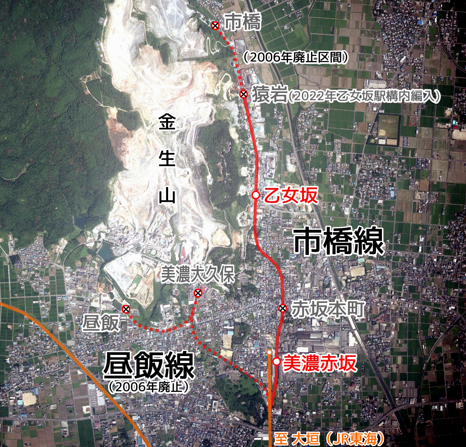
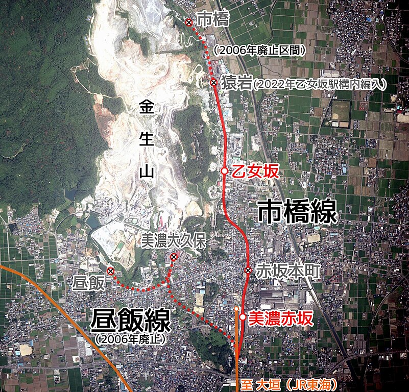
English: Seino Railway Linemap. 日本語: 西濃鉄道路線図 |
| Date | |
| Source |
|
| Author |
Licensing

|
The copyright holder of this file, Geospatial Information Authority of Japan, allows anyone to use it for any purpose, provided that the copyright holder is properly attributed. Redistribution, derivative work, commercial use, and all other use is permitted. |
Attribution:
Maps and Aerial Photographs Browsing Service by Geospatial Information Authority of Japan
|
File history
Click on a date/time to view the file as it appeared at that time.
| Date/Time | Thumbnail | Dimensions | User | Comment | |
|---|---|---|---|---|---|
| current | 10:20, 17 July 2023 | | 1,619 × 1,553 (2.94 MB) | wikimediacommons>ButuCC | Update |
File usage
There are no pages that use this file.