Williamson Diamond Mine in Mwadui, Tanzania.jpg
From Underfoot
Original file (4,977 × 1,825 pixels, file size: 5.47 MB, MIME type: image/jpeg)
This file is from Wikimedia Commons and may be used by other projects. The description on its file description page there is shown below.
Summary
| DescriptionWilliamson Diamond Mine in Mwadui, Tanzania.jpg |
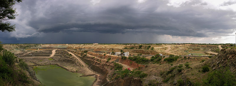
English: Williamson Diamond Mine in Mwadui, Tanzania
Deutsch: Williamson Diamant-Mine in Mwadui, Tansania
Français : Mine de diamant Williamson à Mwadui, Tanzanie |
||
| Date | |||
| Source | Own work: Hansueli Krapf (User Simisa (talk · contribs)) | ||
| Author | Hansueli Krapf | ||
| Permission (Reusing this file) |
Creative Commons Attribution ShareAlike 3.0
|
| Camera location | 3° 31′ 14.8″ S, 33° 36′ 16.82″ E | View this and other nearby images on: OpenStreetMap |
|---|
Licensing
- You are free:
- to share – to copy, distribute and transmit the work
- to remix – to adapt the work
- Under the following conditions:
- attribution – You must give appropriate credit, provide a link to the licence, and indicate if changes were made. You may do so in any reasonable manner, but not in any way that suggests the licensor endorses you or your use.
- share alike – If you remix, transform, or build upon the material, you must distribute your contributions under the same or compatible licence as the original.
Captions
Items portrayed in this file
depicts
some value
3°31'14.801"S, 33°36'16.819"E
28 January 2009
0.0097656 second
4.5
8.9 millimetre
image/jpeg
5,737,640 byte
1,825 pixel
4,977 pixel
b58422c8e3f125c89c82fee10532cbd49a359b28
File history
Click on a date/time to view the file as it appeared at that time.
| Date/Time | Thumbnail | Dimensions | User | Comment | |
|---|---|---|---|---|---|
| current | 06:09, 27 June 2010 | 4,977 × 1,825 (5.47 MB) | wikimediacommons>Simisa | Original size, tilt removed |
File usage
There are no pages that use this file.
Metadata
This file contains additional information, probably added from the digital camera or scanner used to create or digitise it.
If the file has been modified from its original state, some details may not fully reflect the modified file.
| Camera manufacturer | NIKON |
|---|---|
| Camera model | E8800 |
| Exposure time | 12,207/1,250,000 sec (0.0097656) |
| F Number | f/4.5 |
| ISO speed rating | 50 |
| Date and time of data generation | 13:25, 28 January 2009 |
| Lens focal length | 8.9 mm |
| Latitude | 3° 31′ 14.8″ S |
| Longitude | 33° 36′ 16.82″ E |
| Label | Wikimedia Commons |
| Orientation | Normal |
| Horizontal resolution | 300 dpi |
| Vertical resolution | 300 dpi |
| Software used | Capture NX 2.2.4 W |
| File change date and time | 08:04, 27 June 2010 |
| Y and C positioning | Centred |
| Exposure Program | Normal program |
| Exif version | 2.2 |
| Date and time of digitising | 13:25, 28 January 2009 |
| Meaning of each component |
|
| APEX exposure bias | 0 |
| Maximum land aperture | 3.1 APEX (f/2.93) |
| Metering mode | Pattern |
| Light source | Unknown |
| Flash | Flash did not fire, compulsory flash suppression |
| Supported Flashpix version | 1 |
| Colour space | sRGB |
| File source | Digital still camera |
| Scene type | A directly photographed image |
| Custom image processing | Normal process |
| Exposure mode | Auto exposure |
| White balance | Auto white balance |
| Digital zoom ratio | 0 |
| Focal length in 35 mm film | 35 mm |
| Scene capture type | Standard |
| Scene control | None |
| Contrast | Normal |
| Saturation | Normal |
| Sharpness | Normal |
| Subject distance range | Unknown |
| GPS time (atomic clock) | 13:25 |
| Satellites used for measurement | 0 |
| Geodetic survey data used | WGS-84 |
| GPS date | 28 January 2009 |
| GPS tag version | 0.0.2.2 |
| Urgency | 1 |
| Keywords |
|
| Code for country shown | TZA |
| Sublocation of city shown | Mwadui |
| Country shown | Tanzania |
| IIM version | 4 |