Toothrock Tunnel
From Underfoot
Q98828553
'
1937
Wikimedia, WikidataUnited States,

Location: 45.6382, -121.9358, KML, Cluster Map, Maps,
2 places
-

Mitchell Point Tunnel ⓘ
former tunnel of the Historic Columbia River Highway -

Toothrock Tunnel ⓘ
1937-01-01T00:00:00Z
1937-01-01T00:00:00Z
1937 Toothrock Tunnel
{"selectable":false,"showCurrentTime":false,"width":"100%","zoomMin":100000000000}
 Spokane, Portland and Seattle Railway (BN&SF) tunnel through Tooth Rock.
 Bonneville Illuminated Tunnel, Columbia River Highway, Oregon, near Bonneville Dam (63082)
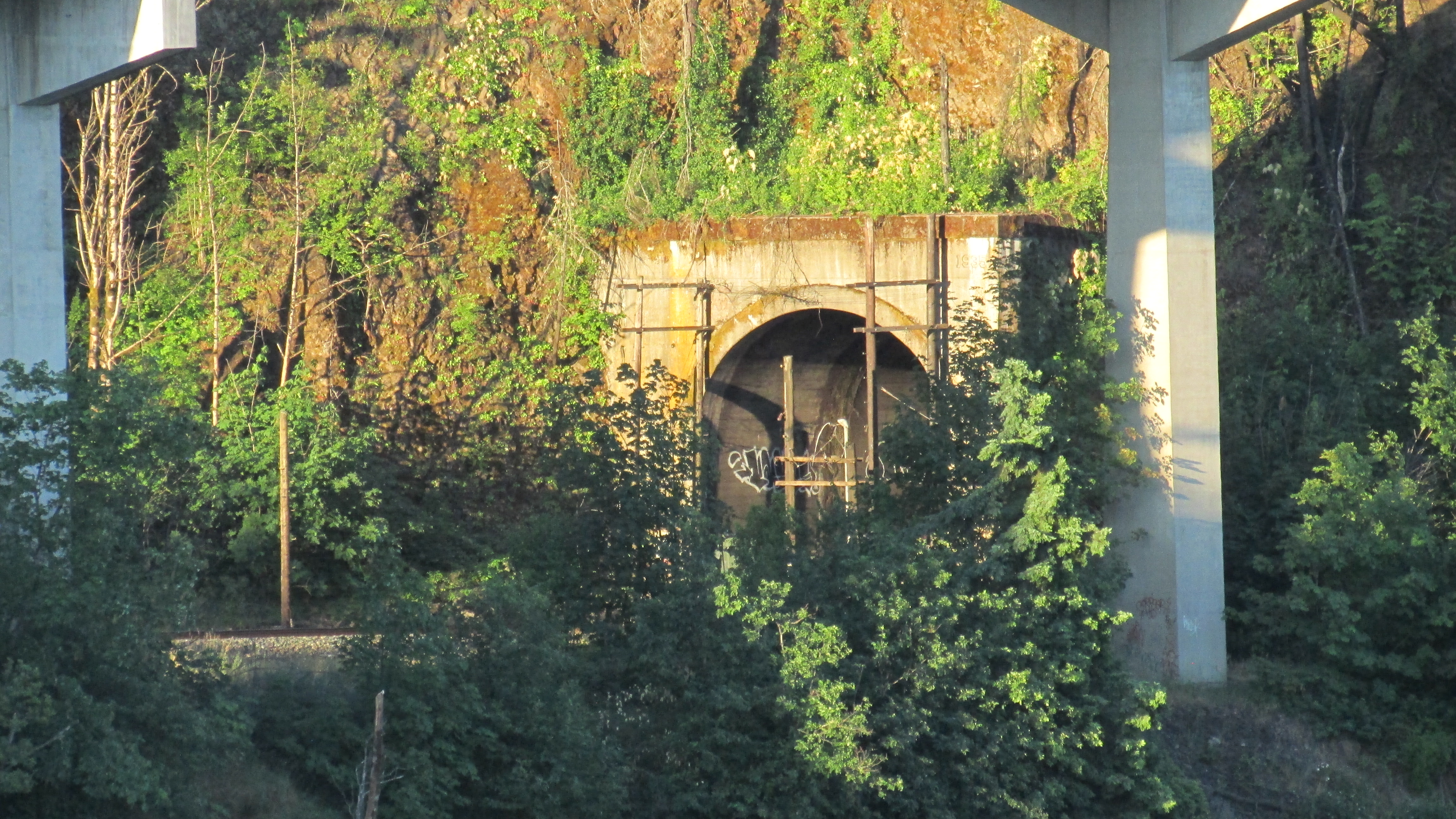
 Interstate 84 (west) and the Historic Columbia River Highway viaduct skirting Tooth Rock.
 Bonneville Illuminated Tunnel, Columbia River Highway, Oregon, near Bonneville Dam (69082)
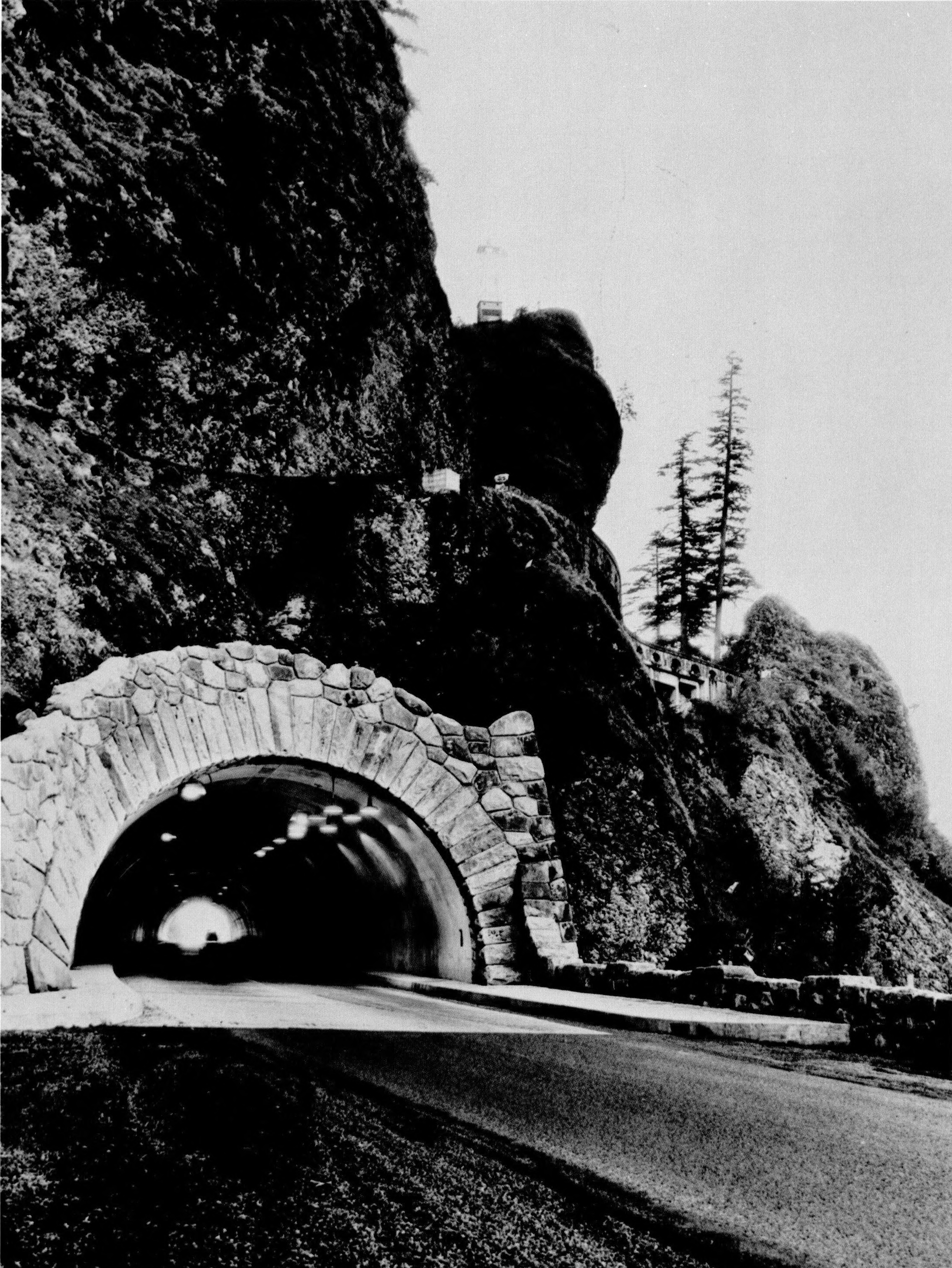 America's Highways 1776–1976 - page 492
 HAER HCRH OR-36-O-1
 HAER HCRH OR-36-O-2
 HAER HCRH OR-36-73
 Ferry hull goes through Toothrock Tunnel (8552150860)
 It just fits through (8551054337)
| Type | Subtype | Date | Description | Notes | Source |
|---|---|---|---|---|---|
| link | page | Oregon Historic Sites Database page@ | Wikidata | ||
| site | tunnel | Mitchell Point Tunnel | tunnel | Wikidata | |
| site | tunnel | 1937 | Toothrock Tunnel | road tunnel | Wikidata |
| commons | image | Spokane, Portland and Seattle Railway (BN&SF) tunnel through Tooth Rock. | Commons | ||
| commons | image | Bonneville Illuminated Tunnel, Columbia River Highway, Oregon, near Bonneville Dam (63082) | Commons | ||
| commons | image | Interstate 84 (west) and the Historic Columbia River Highway viaduct skirting Tooth Rock. | Commons | ||
| commons | image | Bonneville Illuminated Tunnel, Columbia River Highway, Oregon, near Bonneville Dam (69082) | Commons | ||
| commons | image | America's Highways 1776–1976 - page 492 | Commons | ||
| commons | image | HAER HCRH OR-36-O-1 | Commons | ||
| commons | image | HAER HCRH OR-36-O-2 | Commons | ||
| commons | image | HAER HCRH OR-36-73 | Commons | ||
| commons | image | Ferry hull goes through Toothrock Tunnel (8552150860) | Commons | ||
| commons | image | It just fits through (8551054337) | Commons | ||
.jpg)
.jpg)
.jpg)
.jpg)